Stone, Water, Surprise
Europe's landscape preserves sudden moments of rapid cooling, hydraulic destruction, and thermal upheaval. Examine the precise geology behind these abnormal topographies.
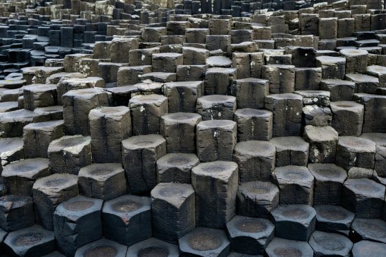 County Antrim, Northern Ireland
Giant's Causeway
Along the rugged edge of the North Channel in County Antrim, the coastline resolves into an uncanny geometric floor. Approximately 40,000 interlocking columns, predominately hexagonal but also featuring pentagons and septagons, stretch from the base of the cliffs into the Atlantic waves.
During the Paleocene Epoch roughly 60 million years ago, volcanic activity forced molten basalt through chalk beds to form an expansive lava plateau. As the dense tholeiitic basalt cooled slowly and shrank, contraction stresses pulled the rock into regular polygonal columns, a physical phenomenon known as columnar jointing.
- Coordinates: 55°14′27″ N, 6°30′42″ W
- Rock Type: Tholeiitic basalt
- Management: National Trust & UNESCO World Heritage
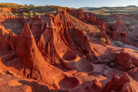 León, Spain
Las Médulas
In the region of El Bierzo, steep orange and rust-coloured towers burst through dense sweet chestnut forests. This is neither a natural canyon nor a conventional quarry; it is the physical remnant of ancient Rome's most aggressive gold exploitation technique: ruina montium (wrecking of mountains).
Described by Pliny the Elder in his Naturalis Historia, Roman engineers carved networks of tunnels inside the gravel mountains and suddenly flooded them with water transported by aqueducts from the Sierra de La Cabrera. The sudden build-up of air pressure and water mass literally collapsed the mountain walls, washing gold-bearing silt into sluices below.
The resulting terrain is a surreal blend of Roman industrial wreckage and regenerated flora, leaving red escarpments that cast dramatic evening shadows.
- Active Period: 25 BCE to early 3rd century CE
- Volume Displaced: Estimated 96,000,000 cubic metres
- Classification: Cultural Landscape World Heritage
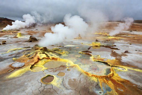 Mývatn, Iceland
Hverir Geothermal Sinks
Beneath the foot of Mount Námafjall lies a stark plateau entirely devoid of vegetation. Instead of grass or forest, the earth consists of ochre, copper-green, and pale yellow clays boiling in open vents. Fumaroles hiss under high pressure inside dry stone cairns, while grey mud cauldrons bubble with liquefied sulphur.
Hverir sits directly on the Mid-Atlantic Ridge, where continental drift pulls the North American and Eurasian tectonic plates apart. Magma chambers located merely two to three kilometres below heat groundwater to temperatures above 200°C, precipitating iron sulphides that deposit deep black sediments into the grey slurry.
- Volcanic System: Krafla Volcanic Complex
- Thermal Output: Active fumaroles and mud cauldrons
- Predominant Minerals: Sulphur, silica, gypsum